GIS & Remote Sensing Services
Comprehensive GIS and Remote Sensing solutions for meticulous planning, efficient asset management, and robust infrastructure development across diverse sectors.
Explore Advanced Mapping Solutions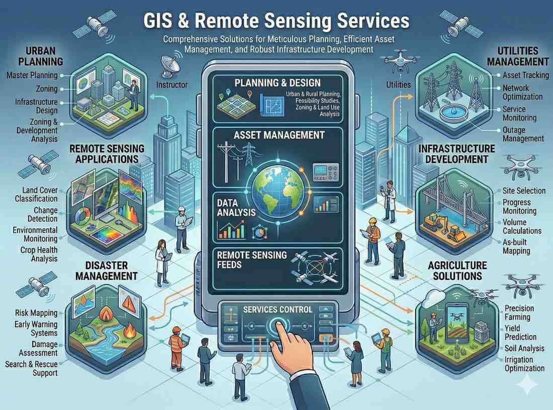
Comprehensive GIS and Remote Sensing solutions for meticulous planning, efficient asset management, and robust infrastructure development across diverse sectors.
Explore Advanced Mapping SolutionsOur GIS & Remote Sensing Services provide fundamental spatial intelligence for critical decision-making. We offer end-to-end solutions from data acquisition to advanced analysis.
Why this service stands out
Gain precise spatial data for superior urban and infrastructure planning.
Efficiently track and manage assets with detailed GIS mapping solutions.
Utilize robust spatial databases for strategic and confident decisions.
Minimize operational costs through streamlined data and resource management.
Better insights into water resources and environmental planning.
Accelerate project timelines with readily available and accurate spatial information.
What makes this service stand out
Accurate digitization and mapping of infrastructure assets, properties, and essential networks like storm water and sewerage.
Creation of robust and organized spatial databases, serving as a reliable foundation for all your geospatial projects.
Procurement and advanced processing of satellite data for detailed land analysis and monitoring applications.
Specialized GIS mapping and management for water, sewer, gas, and oil pipelines, ensuring efficient asset tracking.
In-depth studies for groundwater and surface water management, including watershed analysis and potential mapping.
Producing thematic maps and performing complex spatial analysis to uncover patterns and derive actionable insights.
How we deliver results
Identify project scope, data sources, and specific mapping requirements with our experts.
Process satellite imagery, digitize assets, and develop base maps and spatial databases.
Perform spatial analysis, thematic mapping, and generate insights for your project.
Provide maps, reports, and integrate GIS solutions into your existing systems.